


Topic starter
05/04/2022 1:31 pm
After nearly a year of non-stop experiments and a variety of technical methods, hiFleet finally broke through the generation technology of multi-scale global ship traffic flow map, greatly reducing the generation time and calculation cost of traffic flow map. We have provided the traffic flow analysis this year. You can view the page by the following route: Home page - Layer(on the top right corner) - Traffic Flows
If your company would like to customize the traffic flow map, please contact us by support@hifleet.com.
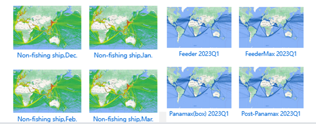
The traffic flow map for non-fishing ships in Dec.

Let's look at the large scale graph.

The Black Sea in January 2023

The Persian Gulf in January 2023

Changjiang in January 2023

The picture is just like an art.
The historical route data of ships in waters for 5 to 10 years can be used for traffic flow analysis, according to the ship type, size, draft, direction, nationality, age and other conditions, in visual ways such as charts or customized forms, assist in the application of project research, channel and bridge planning, evaluation reports and so on.

APP download
Go to our web: www.hifleet.com
Contact us: support@hifleet.com
Topic starter
05/04/2022 1:33 pm
Another clustering analysis for Yangzte river near Nanjing.


Navigational risk analysis based on GIS spatiotemporal trajectory mining: a case study in Nanjing Yangtze River Bridge waters,Arabian Journal of Geosciences (2021) 14:229
This post was modified 4 years ago by hifleet
Topic starter
05/04/2022 1:34 pm
Ship speed distribution in the waters of Singapore strait.

The tug trajectories in Singapore strait.

This post was modified 4 years ago by hifleet
Topic starter
05/04/2022 1:37 pm
Traffic distribution
